Printable North America Countries List
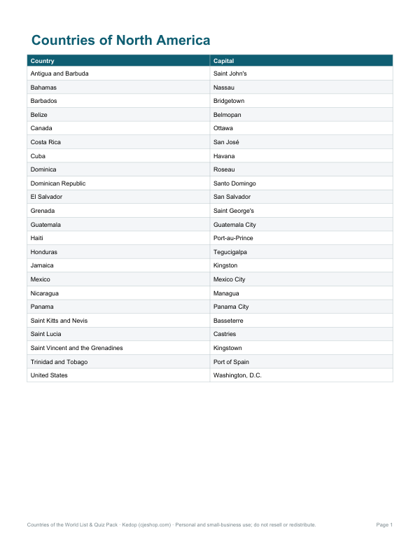
This one-page sheet is for students, teachers, and anyone reviewing North America geography. It lists countries of North America in two columns: Country and Capital. Examples include Antigua and Barbuda — Saint John's, Bahamas — Nassau, and Barbados — Bridgetown.
Free printable · PDF
- 1 page
- US Letter — choose “Fit to page” for A4
- PDF, 73 KB
Free for personal, family and classroom use.
Use it as a quick reference while studying maps, filling out worksheets, or checking capital-city pairs. Print it for class folders, desk reference, or quiz prep. The clean layout makes it easy to scan, compare, and review each country and its capital at a glance.
Good for
- Classroom geography review
- Capital city study sheet
- Quick quiz practice
Tip: Print on standard Letter paper and keep it beside a blank map for faster review.
10 files · PDF, XLSX, DOCX
Get every sheet: Countries of the World List & Quiz Pack
This sheet plus 8 more in one download, with the editable Excel and Word files. All 195 countries with capitals and continents as a printable list and sortable Excel sheet, countries by continent pages, capital quiz sheets with keys and a countries checklist.
$5.00 USD, one-time 10 files · about $0.50 each
- Instant download
- 7-day refund
- Secure checkout by Stripe
7-day money-back guarantee. Full refund within 7 days of purchase, even after you download.
More free printables
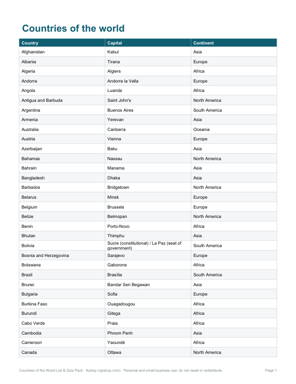 Printable Countries and Capitals List6 pages · free PDF
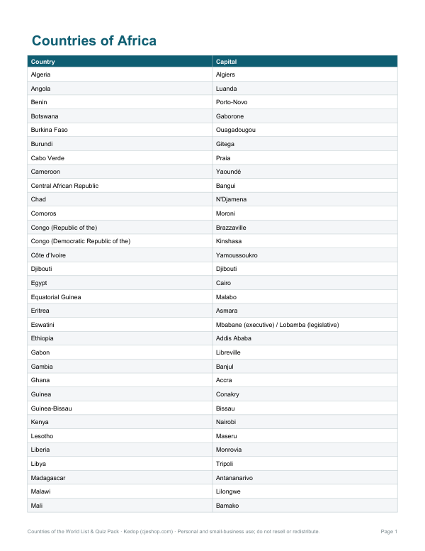 Printable Africa Countries Chart2 pages · free PDF
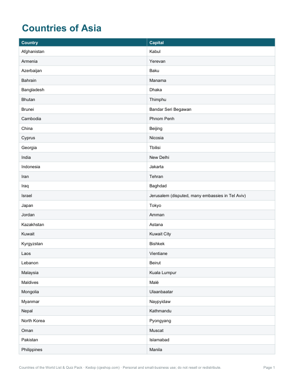 Printable Asia Countries and Capitals List2 pages · free PDF
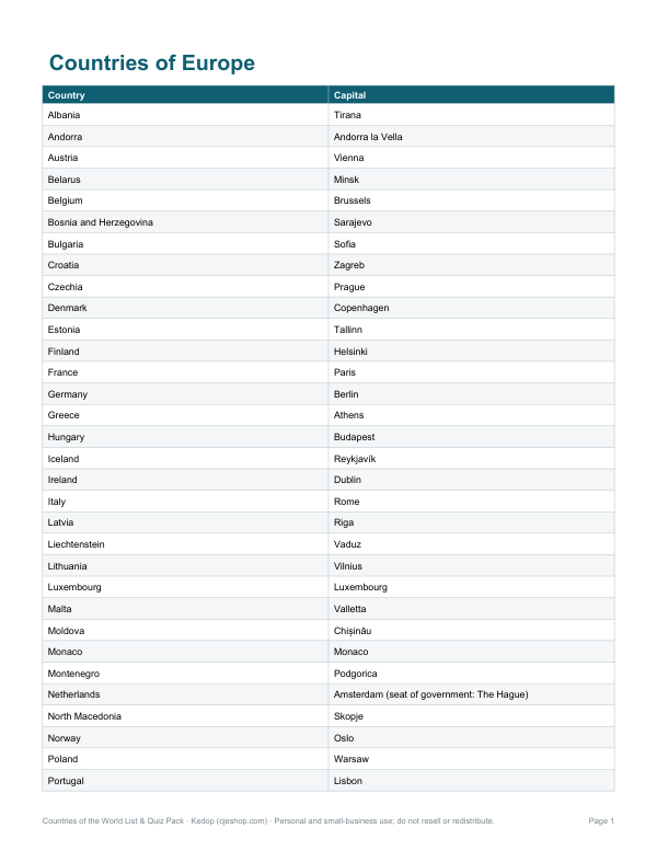 Printable Europe Countries List2 pages · free PDF
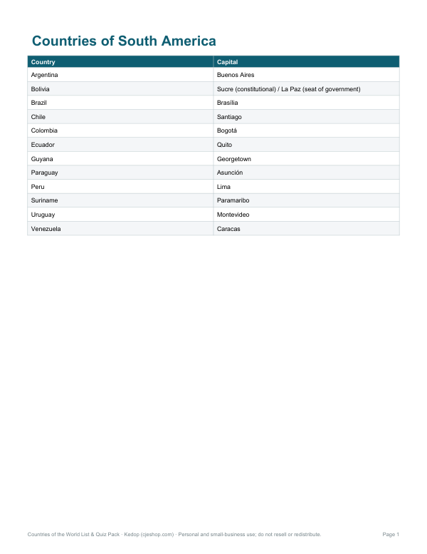 Printable South America Countries List1 page · free PDF
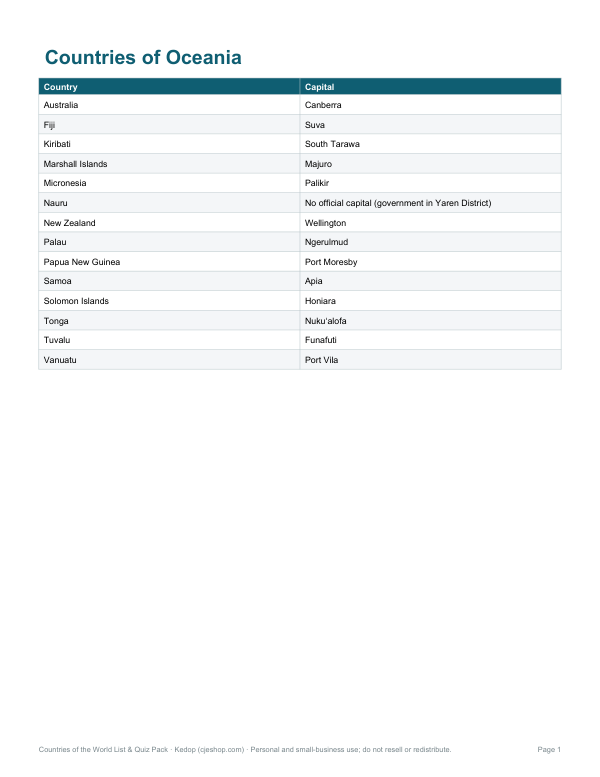 Printable Oceania Countries List1 page · free PDF